Dundee sits on the north bank of the Firth of Tay, a city shaped by its river and its history. With an estimated population of 148,000 and a location where the Tay meets the North Sea, the local soils range from glacial tills to estuarine silts and alluvial deposits. These conditions mean that soil erosion is a real concern for developments near the waterfront, along the Dighty Burn, or on the Sidlaw Hills. We provide a thorough soil erosion analysis that identifies vulnerable areas before construction begins. Our team uses field inspection and laboratory testing to quantify erosion potential, linking directly with a full study of soil mechanics when the project demands deeper understanding of the ground behaviour.
Erosion in Dundee often follows hidden paths: old drainage lines beneath reclaimed land can trigger sudden slope failures years after construction.
Process overview
Local context
In Dundee, we often see that the biggest erosion risk is not the river itself but the forgotten drainage from old industrial sites. Mains of Fintry, the former gasworks along the Tay, and disused railway embankments all have made ground that can wash out under heavy rain. If a developer only looks at the surface, they miss the subsurface flow that carries fine particles away. That is why a proper soil erosion analysis must include both visual inspection and a check of historical maps. We also cross-reference findings with the slope stability assessment when the site lies on any incline above 8 degrees — a common scenario in the hills around Lochee and Broughty Ferry.
Reference standards
BS 5930:2015 – Code of practice for ground investigations, Eurocode 7 – Geotechnical design (EN 1997-1:2004), BS EN 1997-2:2007 – Ground investigation and testing, FHWA-NHI-05-083 – Erosion control manual
Additional services
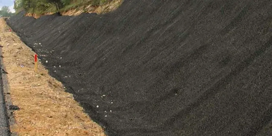
Field erosion mapping and risk zoning
GPS-based mapping of active erosion features (rills, gullies, undercut banks) with photographic documentation. We produce a risk-zoning plan that highlights priority areas for mitigation.
RUSLE modelling and sediment yield
Quantitative estimate of soil loss using the Revised Universal Soil Loss Equation, calibrated with local rainfall data and soil sampling. Delivered as a report with tables and GIS overlays.
Concentrated flow and pipe erosion assessment
Targeted investigation of subsurface erosion paths using trenching, dye tracing, and borehole inspection. Essential for sites on reclaimed land or former industrial yards.
Mitigation design support
Recommendations for erosion control: slope grading, vegetation selection, geotextile placement, and drainage adjustments. We coordinate with civil engineers to embed solutions in the construction drawings.
Typical parameters
Quick answers
What is the difference between sheet erosion and gully erosion, and which is more common in Dundee?
Sheet erosion removes a thin, uniform layer of topsoil across a slope, while gully erosion cuts deep channels that can reach several metres. In Dundee, sheet erosion is widespread on agricultural slopes and construction sites, but gully erosion appears on steep riverbanks along the Tay and on the Sidlaw Hills. Both are addressed in our analysis.
How much does a soil erosion analysis cost for a typical residential development in Dundee?
For a standard residential plot (0.5–1 hectare), the cost ranges between £690 and £1,950 depending on site complexity, access, and the number of field visits. Larger or steeper sites may require additional testing. We provide a fixed quote after a short site review.
Do I need a soil erosion analysis if my site is on flat ground near the city centre?
Yes, because flat ground in Dundee often means reclaimed land or former industrial fill. Even a 1% slope can generate concentrated flow along old foundations or service trenches. We have seen erosion damage on seemingly flat sites in the Nethergate area due to buried drainage paths.
What does the final report include, and how long does it take to receive it?
The report includes field observations, erosion risk zoning, RUSLE calculations, and mitigation recommendations. It complies with BS 5930 and Eurocode 7. Typical turnaround is 10–15 working days from the site visit, with an urgent service available for an additional fee.